PhotoCAD Guides
PhotoCAD turns the photographs, orthophotos, and scans from your excavation into stone-by-stone plans, sections, and elevations, ready for the report or the site plan.
A photogrammetric orthophoto of a trench or feature, straight down with a scale in shot, drafted as a stone-by-stone plan.
Each drawing was converted in PhotoCAD from an excavation photo, an orthophoto, or a laser scan. Drag the slider to compare.
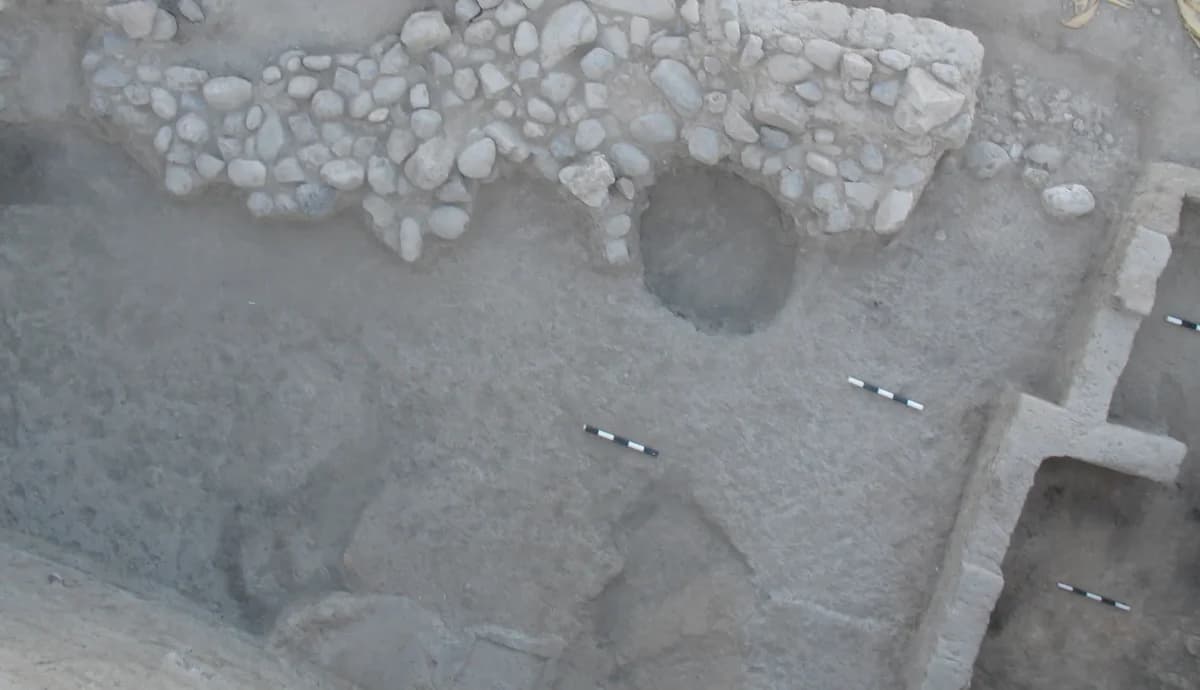

Kenan Tepe, Turkey. Photo: B. Parker and P. Cobb, Open Context, CC BY 4.0, adapted.
An overhead photograph of a trench. PhotoCAD draws the cobble foundation stone by stone, the pit, the mudbrick walls, and the scale bars, and leaves the soil texture out.

| Method | Time | Cost | What you get |
|---|---|---|---|
| Hand planning | Hours on site, then hours inking | Your time | A planning frame and pencil on film at 1:20, then scanned and inked in Illustrator or CAD. |
| Trace the orthophoto | Hours per plan | Your time | Draw over the orthophoto in QGIS, CAD, or Illustrator, every stone by hand. |
| Archaeological illustrator | Days | Day rate, typically $500 | A specialist inks the plans and sections to your house style for the report. |
PhotoCAD's drawing is only as good as the picture it starts from. This is what to capture for each kind of record.
| Drawing | The image to take | Scale it from |
|---|---|---|
| Excavation or trench plan | An orthophoto, or a photo straight down from a mast, a ladder, or a drone | A ranging pole, a scale bar, or two surveyed points |
| Section drawing | The cleaned face, square-on, with string or nails along the interfaces |
Digital recording has moved archaeology from the planning frame to the camera: the trench is photographed, photogrammetry builds an orthophoto, the standing wall is scanned. The drawing has not moved with it. Inking a stone-by-stone plan or a section drawing from those images, in Illustrator, QGIS, or CAD, is still hours of careful tracing for every plan in the archive and the report.
Tracing tools cannot shortcut it, because a photograph of a trench has no lines in it, only soil, stone, and shadow. PhotoCAD works from a semantic understanding of the image. It recognizes the edges of stones, the cut of the trench, the interfaces in a section, the facing of a wall, and draws each as one clean line, leaving out the soil texture, the shadows, and the vegetation. Set the scale from the ranging pole, add context numbers and a north point, and export SVG for the report figure or DXF and DWG for the site plan.
PhotoCAD does the drafting, so the archaeologist's work moves from inking to checking. Compare each drawing with your photographs and field notes, correct it where the image was unclear, and record how it was made.
A ranging pole or scale bar lying flat in the picture makes setting the real size one click.
Upload a trench photo or orthophoto and see PhotoCAD draft the plan stone by stone.
Your first 3 conversions are free — no card required.
A photo from a mast, a ladder, or a drone, or a cleaned section face shot square-on, drafted as a plan or a section.
An orthophoto or a laser-scan view of a ruined wall, an arcade, or a tower, drafted as an elevation.
A drone orthophoto of the whole site, drafted as a site plan, or a mosaic floor drafted pattern by pattern.
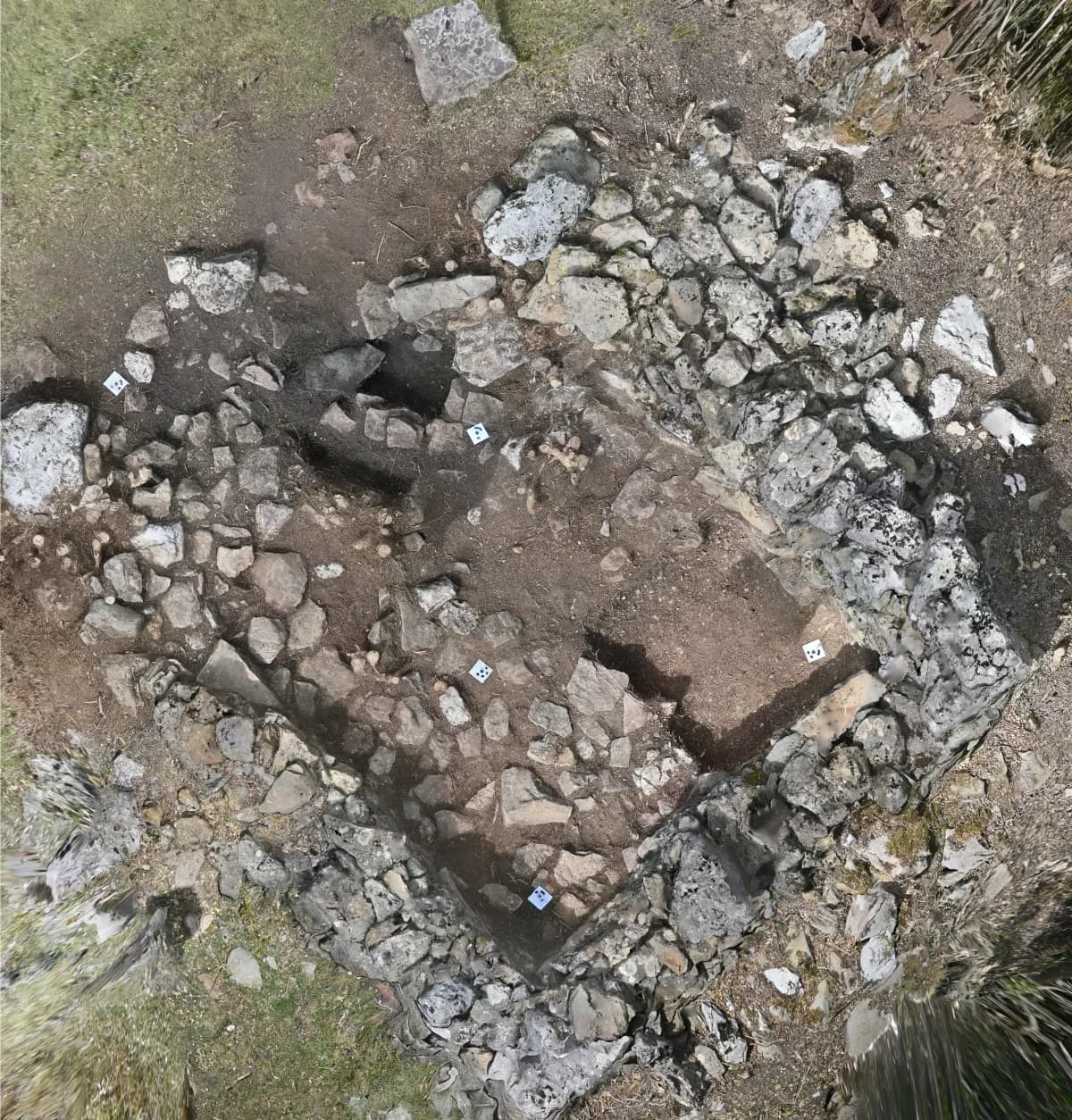
Mallata de Albella, Spain. Orthophoto: D. Garcia-Casas, Incipit-CSIC, CC BY 4.0, adapted.
A photogrammetric orthophoto of an excavated dry-stone hut. PhotoCAD outlines every stone of the walls and of the collapse inside them.
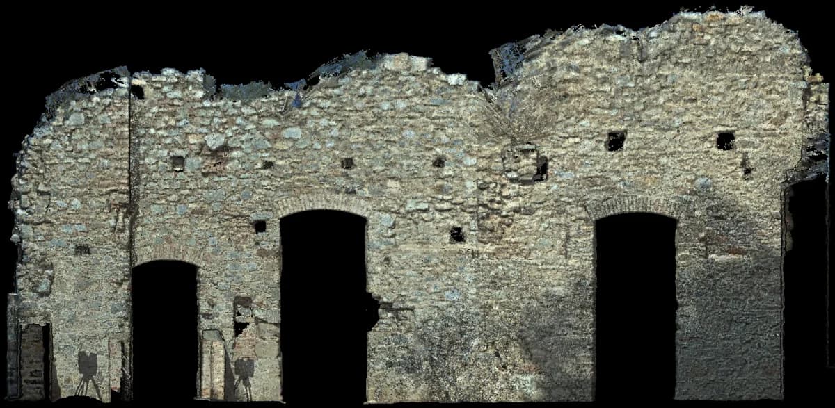

Church ruin, Zobor Hill, Slovakia. Laser scan: P. Gawronek, CC BY 4.0, adapted.
A ruined arcade from a laser scan, seen square-on. PhotoCAD draws the rubble facing, the brick arches, and the putlog holes, stone by stone.
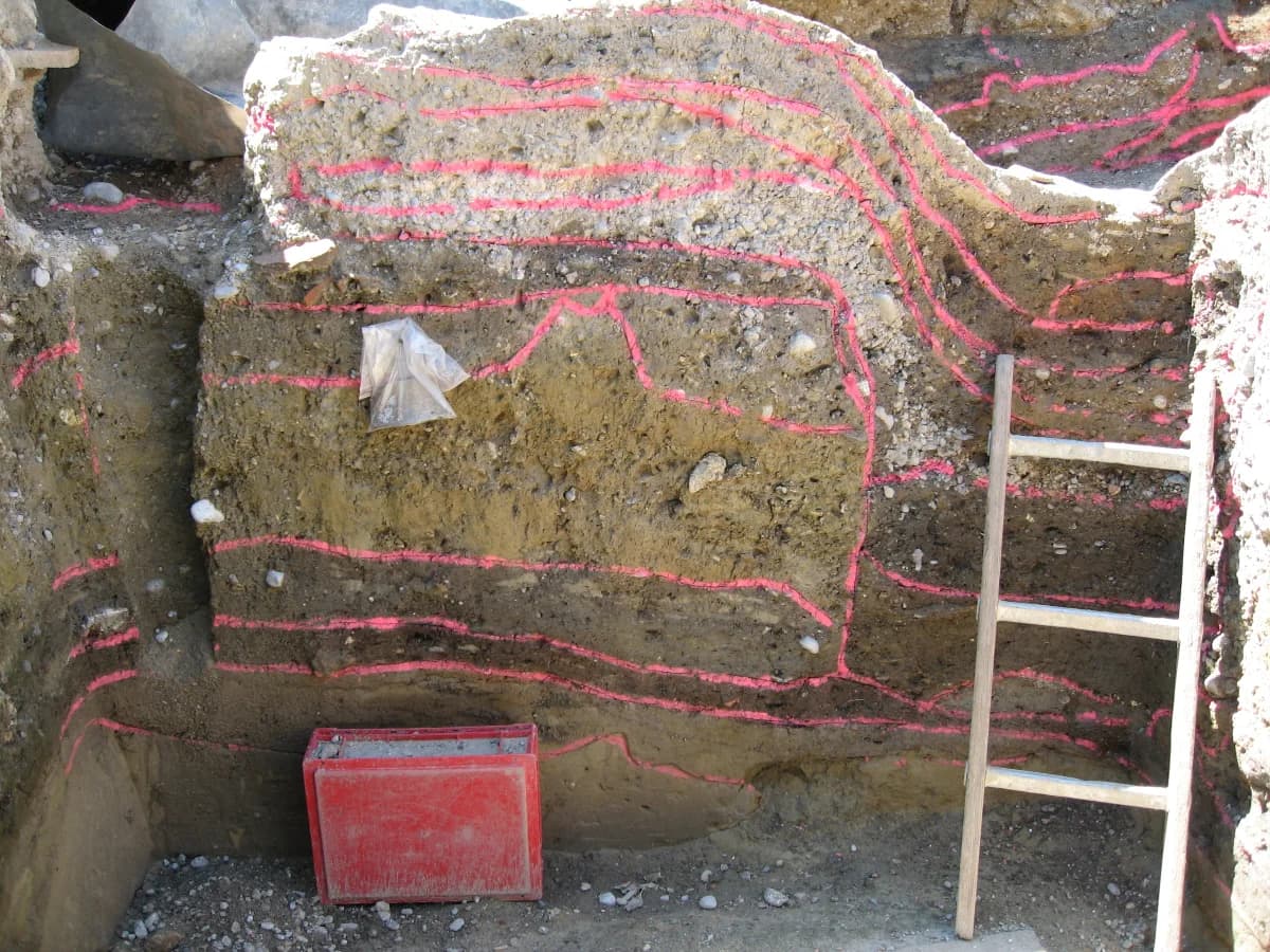

Excavation section, Augsburg, Germany. Photo: Anja Mößbauer, Wikimedia Commons.
A section with string along each layer boundary. PhotoCAD follows the interfaces, draws the stones, and marks the edge of the cut.
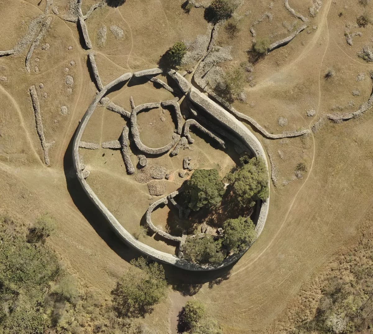

Great Enclosure, Great Zimbabwe. Drone orthophoto: D. Löwenborg and E. Mtetwa, CC BY 4.0, adapted.
A drone orthophoto of the Great Enclosure at Great Zimbabwe. PhotoCAD maps the outer wall, the inner enclosures, and the walls around them.
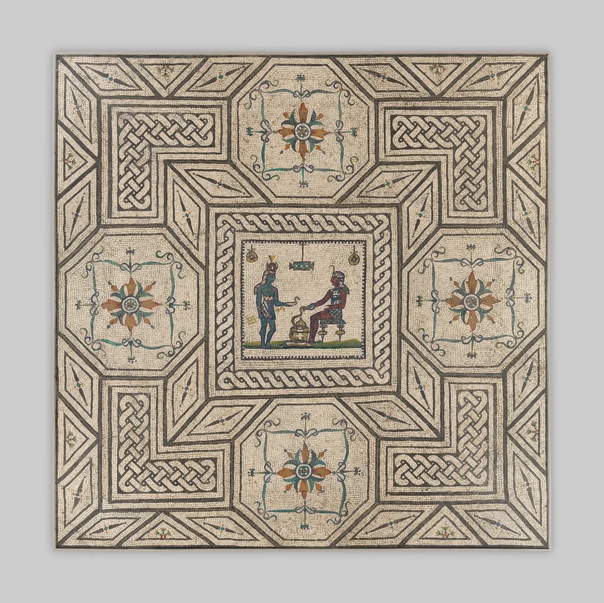

Roman mosaic floor. The Metropolitan Museum of Art.
A Roman mosaic photographed straight down. PhotoCAD draws the borders, the knots, the rosettes, and the figured panel.
 PhotoCAD PhotoCAD | About a minute | ~$1 per drawing | Drafts the photograph or orthophoto as clean linework, stones, cuts, and features, at real scale, as SVG, DXF, or DWG. |
|---|
Clean the surface, put a ranging pole and a north arrow in shot, and photograph from directly above, or build an orthophoto. Photograph sections square-on.
Drop in the JPG, PNG, or TIFF, up to 150 MB. One trench, one section, or one wall per upload.
PhotoCAD recognizes the edges of stones, the cut, the interfaces, and features and draws each as one clean line, leaving out the soil texture and the shadows.
Click the two ends of the ranging pole or the scale bar and type its length. The whole plan scales to match.
Compare the drawing with the photograph and your field notes, and correct anything the image left unclear.
Add context numbers, levels, and a north point, lay the plan on a titled sheet at 1:20, and export SVG for the report figure or DXF and DWG for the site plan.
3 free conversions. No card required.
| The scale bar in shot, or two nails a known distance apart |
| Standing remains | An orthophoto or a laser-scan view of the wall, square-on | A surveyed length or two control points |
|---|
| Burial | An orthophoto or an overhead photo, with a scale and north arrow | The scale bar in shot |
|---|
| Site plan | A drone orthophoto of the site | A surveyed length, or a known distance on the ground |
|---|
| Mosaic or floor | An orthophoto or a square-on photo, section by section | A measured length of the border |
|---|
| Finds | A photo of the object square-on, with a scale | The scale bar |
|---|
For finds drawings (pottery, metalwork, carved stone), see PhotoCAD for heritage and archaeological illustration.
Plans from directly above, sections square-on, or an orthophoto. A photo taken at an angle shrinks whatever is farther from the camera.
Cloud or shade, and a freshly cleaned surface. PhotoCAD tells a shadow from an edge, but a deep shadow can hide the stones inside it.
One trench, feature, section, or wall at a time. A large area goes in parts, laid side by side on the sheet.